
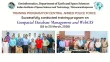
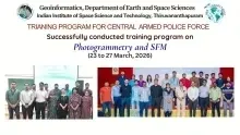
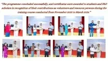
Training Programme for Central Armed Police Forces in the field of Geoinformatics (As part of GeoConnect of IIST)
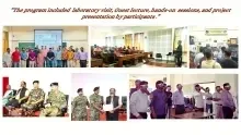
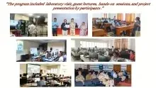
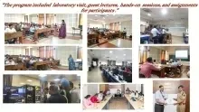
It is six series of programmes reaching out to participants from BSF, CRPF, SSB, ITBP, and IB officials. This training focuses on short-term courses, including Computations and Programming for Geospatial analysis, a comprehensive course on Advanced Remote Sensing Techniques, UAV remote image acquisition and analytics, Active Remote sensing techniques, Geospatial Database Management and WebGIS, Photogrammetry and SFM.
Computations and Programming for Geospatial analysis- 24 November - 05 December 2025
Comprehensive course on Advanced Remote Sensing Techniques- 18 January - 13 February 2026
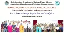
UAV remote image acquisition and analytics- 23 – 27 February 2026
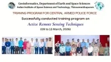
Active Remote sensing techniques- 09 – 13 March 2026,
Geospatial Database Management and WebGIS- 16 – 20 March 2026,
Photogrammetry and SFM - 23 – 27 March 2026.


Venue
Inside IIST
Event Details
-
Mode:In-Person